Running Ruapehu's Round the Mountain track - the "Ring of Fire" Stay at Riverside Apartment Taupo
How to prepare and run an epic, alpine ultra trail run (unsupported)
The idea of completing the Round the Mountain track as a single-day run was one that wouldn't go away. One of those things that gets under your skin and keeps poking your brain until you finally do something about it. Finding information about what was really involved wasn't that easy. Here's how I did it on Monday 27 November 2023, I hope this information is useful to those considering doing the same incredible day out. If you have any questions please use the Disqus chat at the bottom of this page.
Relive the Round the Mountain track run
Why unsupported and why not run it as the Ring of Fire event?
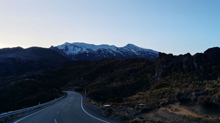
Possible event cancellation and timing was a key factor here. Work commitments, the chance of poor weather on event day and environmental considerations were all taken into account. A three day window was needed (day to drive to position a drop bag then overnight at Whakapapa Village, a day to run it and then a day to drive home via the drop bag location). The longest day (summer solstice in the southern hemisphere) falls around 21 December giving around to 15 hours of daylight between sunrise and sunset. Attempting the run close to this date (plus or minus a month) is ideal in my opinion because the burning heat of January/February has not set in (on a windless day on the central plateau the heat can be intense). Starting/finishing in darkness was not ideal for me - but the first few kms up the Bruce Road and finishing on the well-marked path towards Whakapapa Village is not unsafe.
Clockwise or anti-clockwise?
Knowing the trail and what lies ahead is essential. There is an outstanding Youtube video by RviloNZ that is essential pre-run viewing. Thanks for the video guys, great job!
Unless you are even more mad than your average mad runner, you want to do this anti-clockwise, no argument, starting from Whakapapa Village. The last section on relatively flat ground is done on tired legs, rather than tackling the 'Goat' section last if you were to attempt it in the other direction.
Preparation
Drop bags and hydration
Careful planning is required because nearly all natural water supplies around Mt Ruapehu should not be considered safe for drinking, a cocktail of volcanic chemicals await the unitiated. DOC guidance (and that of a DOC ranger friend) is in agreement - use hut water (recommended to use purification tablets) - or the water at Ohinepango Spings is considered safe to drink.
I used Camelbak's fantastic Octane 22 (with a 2L Fusion hydration pack). While classified as a hiking pack, the Octane 22 is excellent for running too with great strap and comfort adjustment. I am a bit of a "camel" compared to some (I tend to consume less water than my mates do) and every runner will have different consumption requirements, but what worked for me was:
- Drop bag (with food and water) at the Ohakune Mountain Road junction with the Round the Mountain track - I used 1.5L of water over these 27km
- Replenish water at Rangipo hut (use purification tablets) - I smashed through 2.5L of fluids for these 16km
- Replenish water at Ohinepango Springs to get you to the end point
What did I carry with me?
- Sea to Summit's Spark II 850+ loft sleeping bag (didn't plan on using it but it's wonderfully light and compact)
- Seam-sealed jacket
- Thermal layers
- Locator beacon (thanks Dave!)
- Icebreaker gloves
- Food, electrolyte and energy gels
- Small first aid kit
Enough talk, time to run around a mountain
The Ring of Fire talks about three sections. The 'Goat' from Whakapapa Village to the Ohakune Road, Ohakune Road to Waihohonu hut, then the final section back to Whakapapa Village. For me, I would break it down into these slightly different sections, easier to think about and put into compartments:
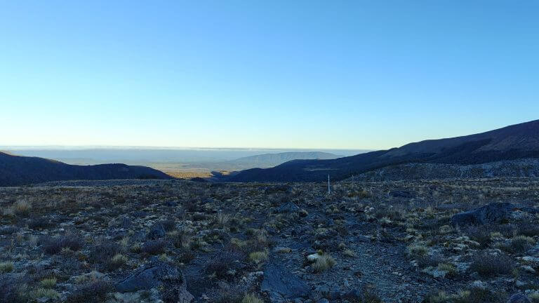
1. Whakapapa Village to a point 3km down Ohakune Mountain Road - 27km
Technical, brutal climbs, slow
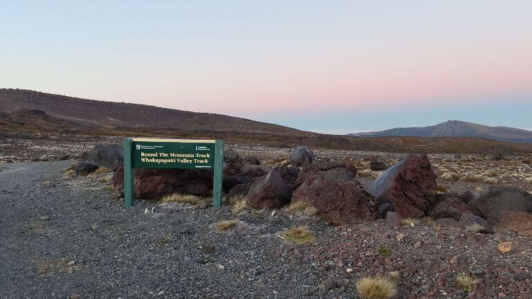
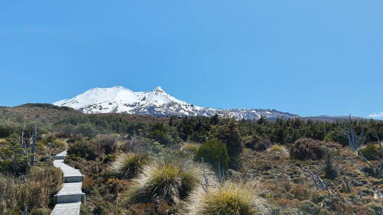
Due to some rain in the previous days I was reluctant to take the Whakapapaiti Valley Track with a possibly high river crossing about 1km north-west of the Whakapapaiti hut. Instead I began the slow, steady climb up the Bruce Road until reaching the branch point of the trail. Technical, volcanic and rocky trails are fairly slow going even though the elevation doesn't change greatly. The steep descent through a series of switchbacks into the Whakapapaiti Valley takes you to the junction where you can continue down the last switchback towards the Whakapapaiti Hut (as I did as a quick side-trip) or take a left to follow the main trail.
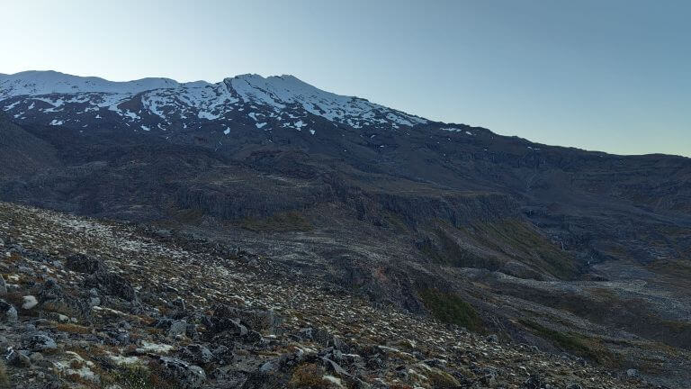
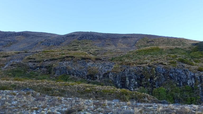
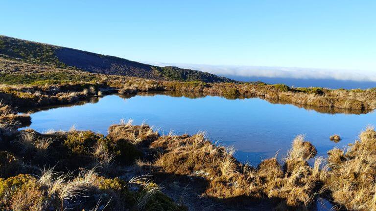
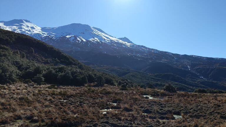
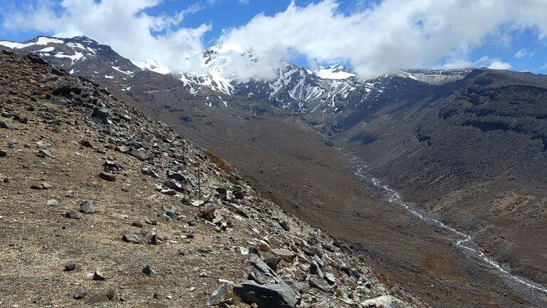
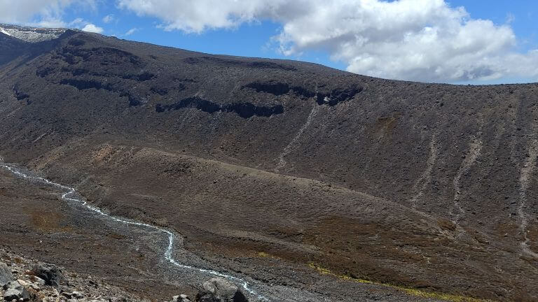
A dozen or so short and sharp valleys give way to the boardwalks around Lake Surprise, the second of two alpine tarns you'll encounter. Dropping 300m into the Mangaturuturu Valley squanders the hard-fought elevation gains from the last 10km. Breath-taking views up the valley to the Lower and Upper Cascades show the decent climb ahead of you, regaining about 300m.
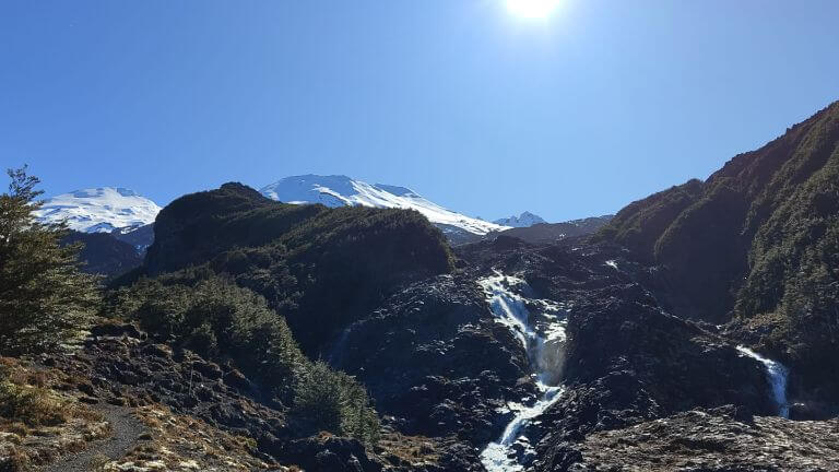
The Cascades are a scramble and the river crossing point is not very clearly marked if you are not keeping an eye out for where you need to get across. The final section to Ohakune Mountain Road is fairly straight forward and then a 3km downhill road run will test the thighs but help your average mins/km! I placed a drop bag in the carpark where the RTM track met this road (and went back the next day to pick up the trash!). About 1.5L of water replaced and a good time to get some solid food into you.
2. From the point 3km down Ohakune Mountain Road - Tukino Village Road - 22km
Varied terrain, short sharp climbs, the amazing Waihianoa Valley
Beech forests, short and steep climbs and the pretty Waitonga Falls are followed by a few swing bridges spanning the streams of the southern slopes. Boardwalked sections mark the transition from the canopy to marshy areas that quickly turn into the arid desert-scape of the eastern side of Ruapehu. A series of up and downs with a steady increase of elevation bring you to the awe-inspiring Waihianoa Valley. The sharp-sighted will spot the swing bridge at the bottom of the valley and the markers snaking up the steep, gravelly face on the other side of the valley - about 100m of slow slog upwards. 2km past the Waihianoa Valley and the well-hidded Rangipo hut marks the highest point on the trail. Refill your hydration pack here, recommended that you drop in purification tablets if it is unboiled water.
In late November there were a few patches of snow on the trail just past the Rangipo hut, I would imagine this would vary with possible recent snow falls, but this was the only sign of snow and ice on my run. Slow and technical still, the trail gradually allows for faster pace by the Tukino Village Access Road.
3. Tukino Village Road - Whakapapa Village 23km
Get into your running rythym, what's left in the tank?
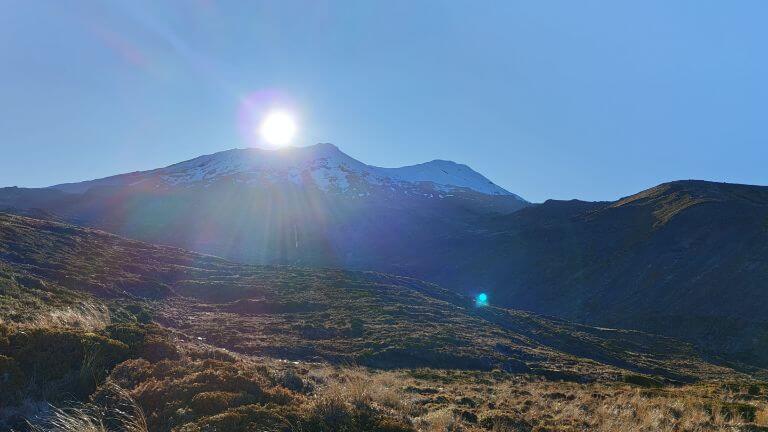
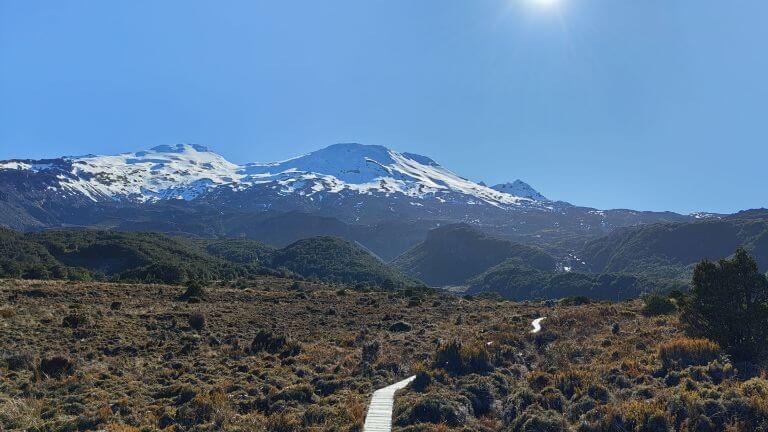
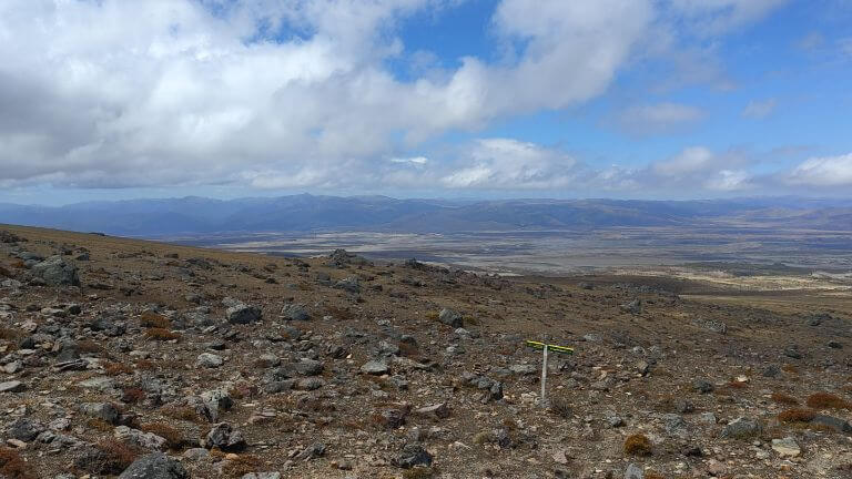
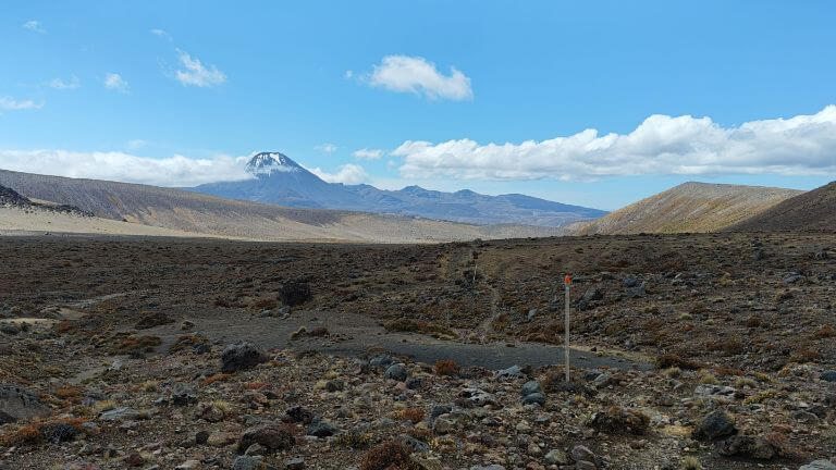
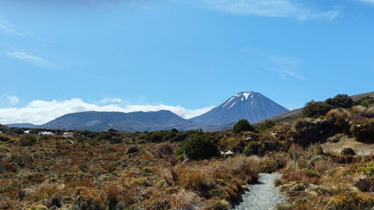
The back of the RTM is broken at this point. Descending into the Mangatoetoenui Valley the arid track becomes more sand and less rock and stone. Downhill gradients allow for good pace to be generated with only small and isolated climbs. Refill your water from the Ohinepango Springs, climb the well-built steps towards the Waihohonu hut and you're on the home straight. There is no need to divert the few hundred metres to the hut (but the historic hut is a nice excursion if you have the motivation) and continue towards the Tama Saddle. The fantastic Mt Ngaruahoe looms large on your right and the westerly wind will funnel through, a curse or blessing depending upon the temperature. Gentle climbs are the worst the last section puts up, the trail is well formed and boardwalks are common. The sight of the iconic Tongariro Chateau can be seen in glimpses from the Tama Saddle before it disappears for the last few kilometres.
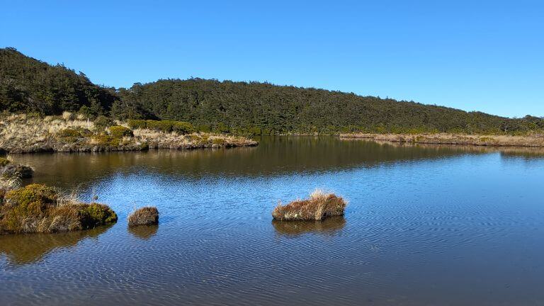
The Taranaki Falls are worth a glimpse (a short side trip) and I suggest you take the Upper Falls Track (on the Ruapehu side) for a quick finish. The best surprise of all? How quickly the Skotel and Chateau pop into view as you take the last bend in the trail at the finish line.
For updates, more information and trail maps please visit the DOC website. However, I would say it's definitely a 72km loop, not 66km!
The stats of the run
Distance: 74.52km (includes a ~2km deviation to Whakapapaiti hut). Gun time: 13:15:35. Moving time: 12:24:19. Average pace: 10:40 per km. Average moving pace: 9:59 per km. Number of stops (water, sunscreen, food): 4. Total ascent/descent: 3,420m. Min elevation: 1,069m. Max elevation: 1,534m.